Mynd:Umdæmi sýslumanna á Íslandi í mars 2019.png

Stærð þessarar forskoðunar: 800 × 566 mynddílar Aðrar upplausnir: 320 × 226 mynddílar | 640 × 453 mynddílar | 1.024 × 724 mynddílar | 1.280 × 905 mynddílar | 2.560 × 1.810 mynddílar | 3.509 × 2.481 mynddílar.
Upphafleg skrá (3.509 × 2.481 mynddílar, skráarstærð: 2,52 MB, MIME-gerð: image/png)
Lýsing
| Lýsing |
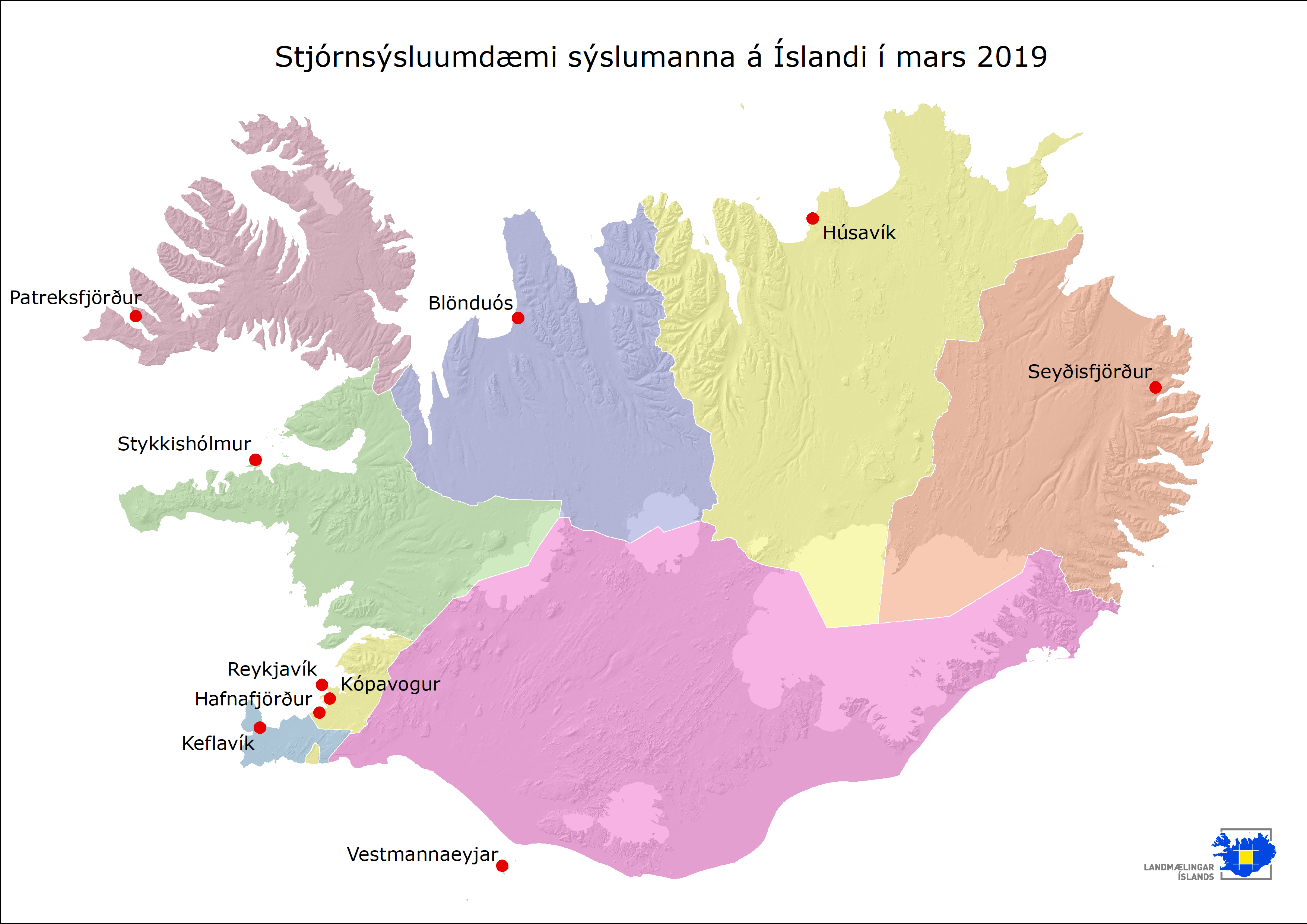
English: Geographical boundaries of the current 9 counties of Iceland according to regulation no 1151/2014. |
| Dagsetning | 30 April 2020, 13:46:10 |
| Uppruni | https://www.lmi.is/static/files/kort/syslumenn.png |
| Höfundarréttarhafi | National Land Survey of Iceland |
Leyfisupplýsingar:

|
The copyright holder of this file allows anyone to use it for any purpose, provided that the copyright holder is properly attributed. Redistribution, derivative work, commercial use, and all other use is permitted. |
Tilvísun höfundarréttar:
Based on data from National Land Survey of Iceland (licence)
|
Breytingaskrá skjals
Smelltu á dagsetningu eða tímasetningu til að sjá hvernig hún leit þá út.
| Dagsetning/Tími | Smámynd | Víddir | Notandi | Athugasemd | |
|---|---|---|---|---|---|
| núverandi | 13. júní 2021 kl. 22:10 | | 3.509 × 2.481 (2,52 MB) | Heimasími | Uploaded a work by National Land Survey of Iceland from https://www.lmi.is/static/files/kort/syslumenn.png with UploadWizard |
Skráartenglar
Eftirfarandi síða notar þessa skrá: