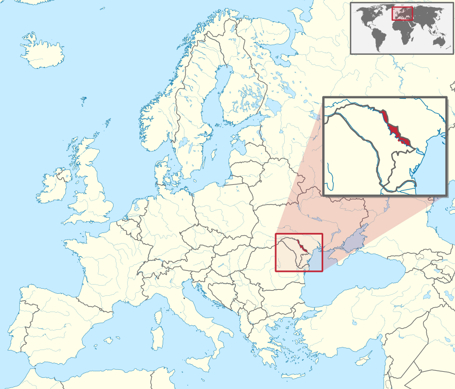
Mynd:Transnistria in Europe (zoomed).svg

Stærð þessarar PNG forskoðunar á SVG skránni: 701 × 599 mynddílar. Aðrar upplausnir: 281 × 240 mynddílar | 561 × 480 mynddílar | 898 × 768 mynddílar | 1.198 × 1.024 mynddílar | 2.395 × 2.048 mynddílar | 1.401 × 1.198 mynddílar.
Upphafleg skrá (SVG-skrá, að nafni til 1.401 × 1.198 mynddílar, skráarstærð: 2,67 MB)
Lýsing

|
This file requires updating because: Artsakh needs removing In doing so, you could add a timestamp to the file.
|
.svg)
.svg)
.svg)
.svg)
.svg)
.svg)
.svg)

-en.svg)

.svg)
.svg)
.svg)

_(US48).svg)
_(small_islands_magnified)_(-mini_map_-rivers).svg)
.svg)
_(extra_close)_(US48).svg)
.svg)
_(zoom).svg)

.svg)


_(UNMIK).svg)
.svg)
_(disputed_hatched).svg)
_(claimed_and_disputed_hatched).svg)
.svg)
.svg)
_(%2Ball_claims_hatched).svg)

.svg)
_(shade).svg)
_(shade)_(special_marker).svg)
_(-mini_map).svg)
_(-mini_map).svg)
_(-mini_map).svg)


.svg)

.svg)
.svg)
Leyfisupplýsingar:
I, the copyright holder of this work, hereby publish it under the following license:
Þessi skrá er með Creative Commons Tilvísun-DeilaEins 3.0 Óstaðfært notkunarleyfi.
- Þér er frjálst:
- að deila – að afrita, deila og yfirfæra verkið
- að blanda – að breyta verkinu
- Undir eftirfarandi skilmálum:
- tilvísun höfundarréttar – Þú verður að tilgreina viðurkenningu á höfundarréttindum, gefa upp tengil á notkunarleyfið og gefa til kynna ef breytingar hafa verið gerðar. Þú getur gert þetta á einhvern ásættanlegan máta, en ekki á nokkurn þann hátt sem bendi til þess að leyfisveitandinn styðji þig eða notkun þína á verkinu.
- Deila eins – Ef þú breytir, yfirfærir eða byggir á þessu efni, þá mátt þú eingöngu dreifa því verki með sama eða svipuðu leyfi og upprunalega verkið er með.

|
I'd greatly appreciate, that you attribute this media file to Wikimedia Commons, if used outside Wikipedia or Commons. For use in publications such as books, newspapers, blogs, websites, please insert here the following line:
|
.svg)
Breytingaskrá skjals
Smelltu á dagsetningu eða tímasetningu til að sjá hvernig hún leit þá út.
| Dagsetning/Tími | Smámynd | Víddir | Notandi | Athugasemd | |
|---|---|---|---|---|---|
| núverandi | 25. ágúst 2014 kl. 09:39 | | 1.401 × 1.198 (2,67 MB) | Nicolay Sidorov | fix border (+Bendery) |
| 9. ágúst 2011 kl. 09:39 |  | 1.401 × 1.198 (4,07 MB) | TUBS | {{Information |Description={{de|Lage von XY (siehe Dateiname) in Europa.}} {{en|Location of XY (see filename) in Europe.}} |Source={{own}}{{Adobe Illustrator}}{{Commonist}}{{AttribSVG|Europe laea location map.svg|Alexrk2}}{{ |
Skráartenglar
Eftirfarandi síða notar þessa skrá:
Altæk notkun skráar
Eftirfarandi wikar nota einnig þessa skrá:
- Notkun á als.wikipedia.org
- Notkun á arz.wikipedia.org
- Notkun á ast.wikipedia.org
- Notkun á az.wikipedia.org
- Notkun á ba.wikipedia.org
- Notkun á bcl.wikipedia.org
- Notkun á be.wikipedia.org
- Notkun á bn.wikipedia.org
- Notkun á ca.wikipedia.org
- Notkun á cdo.wikipedia.org
- Notkun á ce.wikipedia.org
- Notkun á cs.wikipedia.org
- Notkun á cy.wikipedia.org
- Notkun á de.wikipedia.org
- Notkun á diq.wikipedia.org
- Notkun á el.wikipedia.org
- Notkun á en.wikipedia.org
- Notkun á en.wikivoyage.org
- Notkun á es.wikipedia.org
- Notkun á et.wikipedia.org
- Notkun á fi.wikipedia.org
- Notkun á gl.wikipedia.org
- Notkun á hak.wikipedia.org
- Notkun á he.wikipedia.org
- Notkun á hi.wikipedia.org
- Notkun á hsb.wikipedia.org
- Notkun á ht.wikipedia.org
- Notkun á hu.wikipedia.org
- Notkun á hy.wikipedia.org
- Notkun á id.wikipedia.org
- Notkun á incubator.wikimedia.org
- Notkun á it.wikipedia.org
- Notkun á it.wikivoyage.org
- Notkun á ja.wikipedia.org
- Notkun á kk.wikipedia.org
- Notkun á km.wikipedia.org
- Notkun á ko.wikipedia.org
Skoða frekari altæka notkun þessarar skráar.
.svg)
.svg)