Mynd:Stadio Meazza.jpg

Upphafleg skrá (3.608 × 2.232 mynddílar, skráarstærð: 2,02 MB, MIME-gerð: image/jpeg)
Lýsing
| Lýsing |
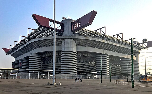
Italiano: stadio Giuseppe Meazza
العربية: ملعب سان سيرو. |
||
| Dagsetning |
(photo) 1925–26 (building) |
||
| Uppruni | eigin skrá | ||
| Höfundarréttarhafi |
App71296 (photo) en:Ulisse Stacchini (1871–1947) (architect) |
| Camera location | | View this and other nearby images on: OpenStreetMap |
|---|
Leyfisupplýsingar:
Architecture:
|
This work is in the public domain in its country of origin and other countries and areas where the copyright term is the author's life plus 70 years or fewer.
| |
| This file has been identified as being free of known restrictions under copyright law, including all related and neighboring rights. | |
Photo:
- Þér er frjálst:
- að deila – að afrita, deila og yfirfæra verkið
- að blanda – að breyta verkinu
- Undir eftirfarandi skilmálum:
- tilvísun höfundarréttar – Þú verður að tilgreina viðurkenningu á höfundarréttindum, gefa upp tengil á notkunarleyfið og gefa til kynna ef breytingar hafa verið gerðar. Þú getur gert þetta á einhvern ásættanlegan máta, en ekki á nokkurn þann hátt sem bendi til þess að leyfisveitandinn styðji þig eða notkun þína á verkinu.
- Deila eins – Ef þú breytir, yfirfærir eða byggir á þessu efni, þá mátt þú eingöngu dreifa því verki með sama eða svipuðu leyfi og upprunalega verkið er með.

|
This image was uploaded as part of Wiki Loves Monuments 2018.
|
 |
Breytingaskrá skjals
Smelltu á dagsetningu eða tímasetningu til að sjá hvernig hún leit þá út.
| Dagsetning/Tími | Smámynd | Víddir | Notandi | Athugasemd | |
|---|---|---|---|---|---|
| núverandi | 1. apríl 2024 kl. 21:52 | | 3.608 × 2.232 (2,02 MB) | FMSky | levels |
| 24. júní 2019 kl. 19:08 |  | 3.608 × 2.232 (4,49 MB) | Ralf Roletschek | Farbraum, aufgerichtet, klarer - bei Nichtgefallen einfach zurücksetzen | |
| 3. september 2018 kl. 13:09 |  | 4.032 × 3.024 (1,79 MB) | App71296 | User created page with UploadWizard |
Skráartenglar
Það eru engar síður sem nota þessa skrá.
Altæk notkun skráar
Eftirfarandi wikar nota einnig þessa skrá:
- Notkun á af.wikipedia.org
- Notkun á ar.wikipedia.org
- Notkun á azb.wikipedia.org
- Notkun á ban.wikipedia.org
- Notkun á cs.wikipedia.org
- Notkun á da.wikipedia.org
- Notkun á de.wikipedia.org
- Notkun á el.wikipedia.org
- Notkun á en.wikipedia.org
- Notkun á es.wikipedia.org
- Supercopa de Europa 1993
- Supercopa de Europa 1990
- Anexo:Grupo B de la Liga de Campeones de la UEFA 2020-21
- Anexo:Grupo H de la Liga Europa de la UEFA 2020-21
- Anexo:Octavos de final de la Liga Europa de la UEFA 2020-21
- Anexo:Grupo D de la Liga de Campeones de la UEFA 2021-22
- Anexo:Octavos de final de la Liga de Campeones de la UEFA 2021-22
- Supercopa de Italia 2021
- Anexo:Octavos de final de la Liga de Campeones de la UEFA 2022-23
- Anexo:Cuartos de final de la Liga de Campeones de la UEFA 2022-23
- Anexo:Semifinales de la Liga de Campeones de la UEFA 2022-23
- Notkun á fa.wikipedia.org
- Notkun á fi.wikipedia.org
- Notkun á fr.wikipedia.org
- Notkun á fy.wikipedia.org
- Notkun á hr.wikipedia.org
- Notkun á id.wikipedia.org
- Notkun á it.wikipedia.org
- Notkun á ja.wikipedia.org
- Notkun á jv.wikipedia.org
Skoða frekari altæka notkun þessarar skráar.