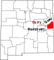
Mynd:Map of New Mexico highlighting Curry County.svg

Stærð þessarar PNG forskoðunar á SVG skránni: 539 × 599 mynddílar. Aðrar upplausnir: 216 × 240 mynddílar | 432 × 480 mynddílar | 691 × 768 mynddílar | 921 × 1.024 mynddílar | 1.842 × 2.048 mynddílar | 5.677 × 6.312 mynddílar.
Upphafleg skrá (SVG-skrá, að nafni til 5.677 × 6.312 mynddílar, skráarstærð: 35 KB)
Breytingaskrá skjals
Smelltu á dagsetningu eða tímasetningu til að sjá hvernig hún leit þá út.
| Dagsetning/Tími | Smámynd | Víddir | Notandi | Athugasemd | |
|---|---|---|---|---|---|
| núverandi | 6. júlí 2024 kl. 00:02 |  | 5.677 × 6.312 (35 KB) | Nux | fix rendering (remove clipping), uniform colors |
| 17. apríl 2009 kl. 11:06 |  | 5.677 × 6.312 (35 KB) | Rfc1394 | Add labels to counties with big font (350 px) | |
| 12. febrúar 2006 kl. 15:30 |  | 5.677 × 6.312 (31 KB) | David Benbennick | {{subst:User:Dbenbenn/clm|county=Curry County|state=New Mexico|type=county}} |
Skráartenglar
Eftirfarandi síða notar þessa skrá:
Altæk notkun skráar
Eftirfarandi wikar nota einnig þessa skrá:
- Notkun á ar.wikipedia.org
- Notkun á bg.wikipedia.org
- Notkun á bpy.wikipedia.org
- Notkun á cdo.wikipedia.org
- Notkun á ceb.wikipedia.org
- Notkun á ce.wikipedia.org
- Notkun á cy.wikipedia.org
- Notkun á de.wikipedia.org
- Notkun á en.wikipedia.org
- List of counties in New Mexico
- Curry County, New Mexico
- Clovis, New Mexico
- Grady, New Mexico
- Melrose, New Mexico
- Texico, New Mexico
- Template:Curry County, New Mexico
- User:Nyttend/County templates/NM
- Category:Populated places in Curry County, New Mexico
- St. Vrain, New Mexico
- National Register of Historic Places listings in Curry County, New Mexico
- Broadview, Curry County, New Mexico
- Bellview, New Mexico
- Cannon Air Force Base
- User:AridCeption/sandbox
- Notkun á es.wikipedia.org
- Notkun á et.wikipedia.org
- Notkun á eu.wikipedia.org
- Notkun á fa.wikipedia.org
- Notkun á fi.wikipedia.org
- Notkun á fr.wikipedia.org
- Notkun á glk.wikipedia.org
- Notkun á hr.wikipedia.org
Skoða frekari altæka notkun þessarar skráar.