Mynd:Kurdish-inhabited area by CIA (1992) box inset removed.jpg

Stærð þessarar forskoðunar: 735 × 599 mynddílar Aðrar upplausnir: 294 × 240 mynddílar | 589 × 480 mynddílar | 975 × 795 mynddílar.
Upphafleg skrá (975 × 795 mynddílar, skráarstærð: 556 KB, MIME-gerð: image/jpeg)
Pkk
Lýsing
| Lýsing |
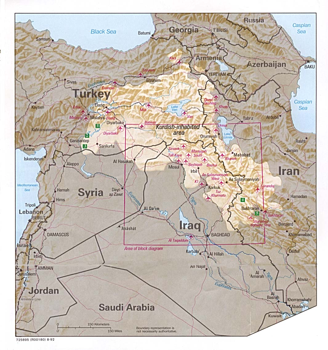
English: Kurdish-inhabited area, by CIA (1992)
Ελληνικά: Περιοχές κατοικούμενες από Κούρδους κατά τη CIA (1992) |
| Dagsetning | |
| Uppruni |
Perry-Castañeda Library Map Collection at The University of Texas at Austin [1] linked from Perry-Castañeda Library Map Collection at The University of Texas at Austin |
| Höfundarréttarhafi |
English: Source stated "The following maps were produced by the U.S. Central Intelligence Agency, unless otherwise indicated." |
| Aðrar útgáfur |
|

_box_inset_removed.jpg)
Leyfisupplýsingar:
| This image is a work of a Central Intelligence Agency employee, taken or made as part of that person's official duties. As a Work of the United States Government, this image or media is in the public domain in the United States.
|

|
See also
- File:Kurdish lands 92.jpg - cropped and down-scaled version of same map apparently first uploaded at English wikipedia in 12 May 2003 from [2] and transferred to Commons on 2007-09-08
- Image:Kurdish lands 92 cropped.jpg - apparently cropped on 15 Jun 2003 (see w:en:Talk:Kurdish people/Archive 1) moved to Commons on or before 2006-12-16 but deleted on 9 February 2007 with comment: Superceeded ny Image:Kurdish-inhabited area by CIA (1992).jpg
.jpg)
Breytingaskrá skjals
Smelltu á dagsetningu eða tímasetningu til að sjá hvernig hún leit þá út.
| Dagsetning/Tími | Smámynd | Víddir | Notandi | Athugasemd | |
|---|---|---|---|---|---|
| núverandi | 6. ágúst 2016 kl. 10:47 | | 975 × 795 (556 KB) | Kintetsubuffalo | User created page with UploadWizard |
Skráartenglar
Eftirfarandi síða notar þessa skrá:
Altæk notkun skráar
Eftirfarandi wikar nota einnig þessa skrá:
- Notkun á ar.wikipedia.org
- Notkun á ast.wiktionary.org
- Notkun á ckb.wikipedia.org
- Notkun á en.wikipedia.org
- Notkun á es.wikipedia.org
- Notkun á fa.wikipedia.org
- Notkun á fi.wikipedia.org
- Notkun á hy.wikipedia.org
- Notkun á id.wikipedia.org
- Notkun á io.wikipedia.org
- Notkun á jv.wikipedia.org
- Notkun á lij.wikipedia.org
- Notkun á mg.wikipedia.org
- Notkun á sq.wikipedia.org
- Notkun á tg.wikipedia.org
- Notkun á tk.wikipedia.org
- Notkun á tr.wikipedia.org
- Notkun á war.wikipedia.org
_box_inset_removed.jpg)