Mynd:Cuba municipalities.png

Stærð þessarar forskoðunar: 800 × 548 mynddílar Aðrar upplausnir: 320 × 219 mynddílar | 640 × 439 mynddílar | 1.024 × 702 mynddílar | 1.280 × 877 mynddílar.
Upphafleg skrá (1.280 × 877 mynddílar, skráarstærð: 27 KB, MIME-gerð: image/png)
Lýsing
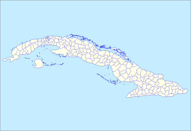
| Lýsing | Map of the municipalities of Cuba. Created by Rarelibra 15:26, 11 April 2007 (UTC) for public domain use, using MapInfo Professional v8.5 and various mapping resources. |
| Dagsetning | 11. apríl 2007 (original upload date) |
| Uppruni | No machine-readable source provided. Own work assumed (based on copyright claims). |
| Höfundarréttarhafi | No machine-readable author provided. Rarelibra assumed (based on copyright claims). |
Leyfisupplýsingar:
| I, the copyright holder of this work, release this work into the public domain. This applies worldwide. In some countries this may not be legally possible; if so: I grant anyone the right to use this work for any purpose, without any conditions, unless such conditions are required by law. |
Breytingaskrá skjals
Smelltu á dagsetningu eða tímasetningu til að sjá hvernig hún leit þá út.
| Dagsetning/Tími | Smámynd | Víddir | Notandi | Athugasemd | |
|---|---|---|---|---|---|
| núverandi | 2. september 2015 kl. 19:13 | | 1.280 × 877 (27 KB) | Milenioscuro | color of the sea |
| 9. júní 2013 kl. 19:10 |  | 1.280 × 877 (45 KB) | DerBorg | added a different color to the sea (to distinguish from the land. note: if my add is redundant, feel free to revert) | |
| 11. apríl 2007 kl. 15:26 |  | 1.281 × 878 (24 KB) | Rarelibra | Map of the municipalities of Cuba. Created by ~~~~ for public domain use, using MapInfo Professional v8.5 and various mapping resources. |
Skráartenglar
Það eru engar síður sem nota þessa skrá.
Altæk notkun skráar
Eftirfarandi wikar nota einnig þessa skrá:
- Notkun á ar.wikipedia.org
- Notkun á da.wikipedia.org
- Notkun á en.wikipedia.org
- Notkun á fr.wikipedia.org
- Notkun á gl.wikipedia.org
- Notkun á ht.wikipedia.org
- Esmeralda, Camagüey
- Florida, Camagüey
- Guáimaro, Camagüey
- Jimaguayú, Camagüey
- Minas, Camagüey
- Najasa, Camagüey
- Nuevitas, Camagüey
- Santa Cruz del Sur, Camagüey
- Sibanicú, Camagüey
- Sierra de Cubitas, Camagüey
- Baraguá, Ciego de Ávila
- Bolivia, Ciego de Ávila
- Chambas, Ciego de Ávila
- Florencia, Ciego de Ávila
- Majagua, Ciego de Ávila
- Primero de Enero, Ciego de Ávila
- Venezuela, Ciego de Ávila
- Abreus, Cienfuegos
- Aguada de Pasajeros, Cienfuegos
- Cienfuegos, Cienfuegos
- Cruces, Cienfuegos
- Cumanayagua, Cienfuegos
- Lajas, Cienfuegos
- Palmira, Cienfuegos
- Rodas, Cienfuegos
- Arroyo Naranjo, Habana
- Boyeros, Habana
- Cerro, Habana
- Diez de Octubre, Habana
- Habana Vieja, Habana
- Plaza de la Revolución, Habana
- Regla, Habana
- Bartolomé Masó, Granma
- Bayamo, Granma
- Buey Arriba, Granma
- Campechuela, Granma
- Cauto Cristo, Granma
- Guisa, Granma
- Jiguaní, Granma
- Manzanillo, Granma
- Media Luna, Granma
- Niquero, Granma
- Pilón, Granma
Skoða frekari altæka notkun þessarar skráar.