Mynd:Achaemenid Empire ~480 BC.png
Það er engin hærri upplausn til.
Achaemenid_Empire_~480_BC.png (600 × 425 mynddílar, skráarstærð: 17 KB, MIME-gerð: image/png)
Lýsing
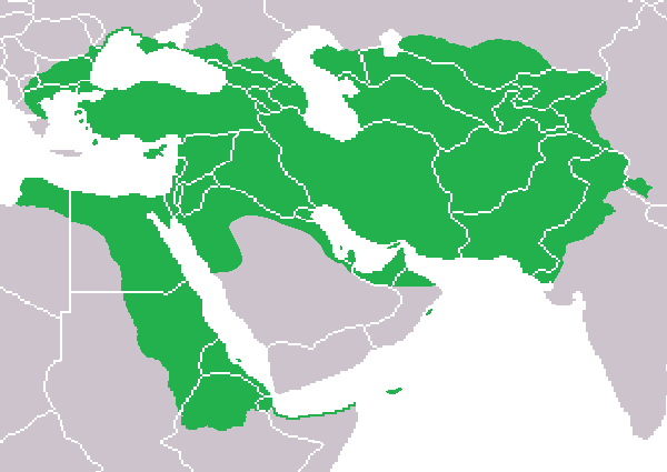
| Lýsing |
English: Map of the Achaemenid Empire at its greatest extent by around ~480 BC. |
| Dagsetning | |
| Uppruni | eigin skrá |
| Höfundarréttarhafi | Aeaige |
Leyfisupplýsingar:
| I, the copyright holder of this work, release this work into the public domain. This applies worldwide. In some countries this may not be legally possible; if so: I grant anyone the right to use this work for any purpose, without any conditions, unless such conditions are required by law. |
Breytingaskrá skjals
Smelltu á dagsetningu eða tímasetningu til að sjá hvernig hún leit þá út.
| Dagsetning/Tími | Smámynd | Víddir | Notandi | Athugasemd | |
|---|---|---|---|---|---|
| núverandi | 5. september 2009 kl. 21:04 | | 600 × 425 (17 KB) | Aeaige | Fixed Arabia Petraea. |
| 9. ágúst 2009 kl. 10:21 |  | 600 × 425 (17 KB) | Aeaige | {{Information |Description={{en|1=Map of the Achaemenid Empire at its greatest extent by around ~480 BC. }} |Source=Own work by uploader |Author=Aeaige |Date=2009-08-09 |Permission=See below. |other_versions= }} [[Category:Maps of the Ac |
Skráartenglar
Eftirfarandi síða notar þessa skrá:
Altæk notkun skráar
Eftirfarandi wikar nota einnig þessa skrá:
- Notkun á ar.wikipedia.org
- Notkun á ckb.wikipedia.org
- Notkun á hr.wikipedia.org
- Notkun á hu.wikipedia.org
- Notkun á id.wikipedia.org
- Notkun á it.wikipedia.org
- Notkun á kk.wikipedia.org
- Notkun á sl.wikipedia.org
- Notkun á sq.wikipedia.org
- Notkun á tl.wikipedia.org
- Notkun á yo.wikipedia.org