Mynd:1761 Homann Heirs Map of Iceland "Insulae Islandiae" - Geographicus - Islandiae-hmhr-1761.jpg
Stærð þessarar forskoðunar: 745 × 600 mynddílar Aðrar upplausnir: 298 × 240 mynddílar | 597 × 480 mynddílar | 954 × 768 mynddílar | 1.272 × 1.024 mynddílar | 2.500 × 2.012 mynddílar.
Upphafleg skrá (2.500 × 2.012 mynddílar, skráarstærð: 1,58 MB, MIME-gerð: image/jpeg)
| Insuale Islandiae | ||||||
|---|---|---|---|---|---|---|
| Listamaður | ||||||
| Titill |
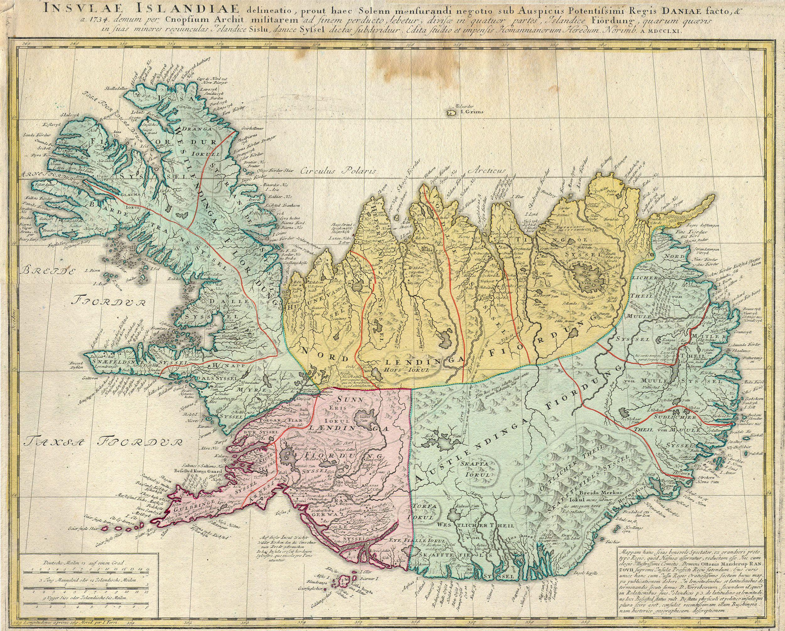
Insuale Islandiae |
|||||
| Lýsing |
English: This is a rare and spectacular 1761 Homann Heirs map depicting Iceland. Fine map of this region compiled according to Danish surveys. Lovers of Icelandic sagas will recognize many of the towns and cities noted. |
|||||
| Dagsetning | 1761 | |||||
| Stærðir | hæð: 19 in (48,2 cm); breidd: 21,5 in (54,6 cm) | |||||
| Accession number |
Geographicus link: Islandiae-hmhr-1761 |
|||||
| Source/Photographer |
|
|||||
| Réttindi (Endurnotkun á þessari skrá) |
|
|||||
Breytingaskrá skjals
Smelltu á dagsetningu eða tímasetningu til að sjá hvernig hún leit þá út.
| Dagsetning/Tími | Smámynd | Víddir | Notandi | Athugasemd | |
|---|---|---|---|---|---|
| núverandi | 24. mars 2011 kl. 10:03 | | 2.500 × 2.012 (1,58 MB) | BotMultichillT | {{subst:User:Multichill/Geographicus |link=http://www.geographicus.com/P/AntiqueMap/Islandiae-hmhr-1761 |product_name=1761 Homann Heirs Map of Iceland "Insulae Islandiae" |map_title=Insuale Islandiae |description=This is a rare and spectacular 1761 Homann |
Skráartenglar
Eftirfarandi 2 síður nota þessa skrá:
Altæk notkun skráar
Eftirfarandi wikar nota einnig þessa skrá:
- Notkun á ar.wikipedia.org
- Notkun á be-tarask.wikipedia.org
- Notkun á be.wikipedia.org
- Notkun á br.wikipedia.org
- Notkun á ca.wikipedia.org
- Notkun á da.wikipedia.org
- Notkun á da.wikibooks.org
- Notkun á de.wikipedia.org
- Notkun á en.wikipedia.org
- Notkun á es.wikipedia.org
- Notkun á fr.wikipedia.org
- Notkun á gd.wikipedia.org
- Notkun á gl.wikipedia.org
- Notkun á hu.wikipedia.org
- Notkun á ja.wikipedia.org
- Notkun á ko.wikipedia.org
- Notkun á nl.wikipedia.org
- Notkun á pt.wikipedia.org
- Notkun á ru.wikipedia.org
- Notkun á sv.wikipedia.org
- Notkun á uk.wikipedia.org