Mynd:Sulu archipelago.png
Það er engin hærri upplausn til.
Sulu_archipelago.png (798 × 512 mynddílar, skráarstærð: 22 KB, MIME-gerð: image/png)
Lýsing
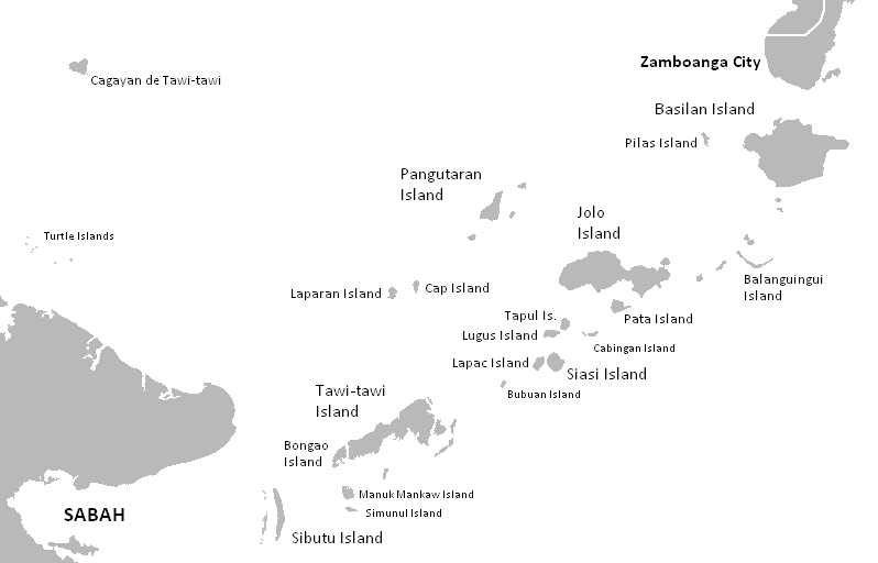
| Lýsing | Location map of Sulu Archipelago |
| Dagsetning | |
| Uppruni | The Coffee's Blank map of the Philippines |
| Höfundarréttarhafi | Kleomarlo |
- Other information
English: Sulu Archipelago
Leyfisupplýsingar:
| I, the copyright holder of this work, release this work into the public domain. This applies worldwide. In some countries this may not be legally possible; if so: I grant anyone the right to use this work for any purpose, without any conditions, unless such conditions are required by law. |
Breytingaskrá skjals
Smelltu á dagsetningu eða tímasetningu til að sjá hvernig hún leit þá út.
| Dagsetning/Tími | Smámynd | Víddir | Notandi | Athugasemd | |
|---|---|---|---|---|---|
| núverandi | 9. maí 2008 kl. 12:34 | | 798 × 512 (22 KB) | Kleomarlo | {{Information |Description=Location map of Sulu Archipelago |Source=The Coffee's Blank map of the Philippines |Date=May 8, 2008 |Author= Kleomarlo |Permission= |other_versions= }} |
Skráartenglar
Eftirfarandi síða notar þessa skrá:
Altæk notkun skráar
Eftirfarandi wikar nota einnig þessa skrá:
- Notkun á ar.wikipedia.org
- Notkun á ast.wikipedia.org
- Notkun á azb.wikipedia.org
- Notkun á az.wikipedia.org
- Notkun á ca.wikipedia.org
- Notkun á ceb.wikipedia.org
- Notkun á cs.wikipedia.org
- Notkun á de.wikipedia.org
- Notkun á en.wikipedia.org
- Notkun á en.wikivoyage.org
- Notkun á es.wikipedia.org
- Notkun á eu.wikipedia.org
- Notkun á fa.wikipedia.org
- Notkun á frr.wikipedia.org
- Notkun á fr.wikipedia.org
- Notkun á gl.wikipedia.org
- Notkun á hi.wikipedia.org
- Notkun á hr.wikipedia.org
- Notkun á hu.wikipedia.org
- Notkun á ilo.wikipedia.org
- Notkun á incubator.wikimedia.org
- Notkun á it.wikipedia.org
- Notkun á ja.wikipedia.org
- Notkun á ka.wikipedia.org
- Notkun á ko.wikipedia.org
- Notkun á mrj.wikipedia.org
- Notkun á mt.wikipedia.org
- Notkun á nl.wikipedia.org
- Notkun á nn.wikipedia.org
- Notkun á no.wikipedia.org
- Notkun á pl.wikipedia.org
- Notkun á pt.wikipedia.org
- Notkun á ro.wikipedia.org
- Notkun á ru.wikipedia.org
- Notkun á species.wikimedia.org
- Notkun á sv.wikipedia.org
- Notkun á ta.wikinews.org
- Notkun á tr.wikipedia.org
Skoða frekari altæka notkun þessarar skráar.