Mynd:Sg-map.png
Það er engin hærri upplausn til.
Sg-map.png (324 × 348 mynddílar, skráarstærð: 9 KB, MIME-gerð: image/png)

|
This locator map image could be re-created using vector graphics as an SVG file. This has several advantages; see Commons:Media for cleanup for more information. If an SVG form of this image is available, please upload it and afterwards replace this template with
{{vector version available|new image name}}.
It is recommended to name the SVG file “Sg-map.svg”—then the template Vector version available (or Vva) does not need the new image name parameter. |
| Lýsing |
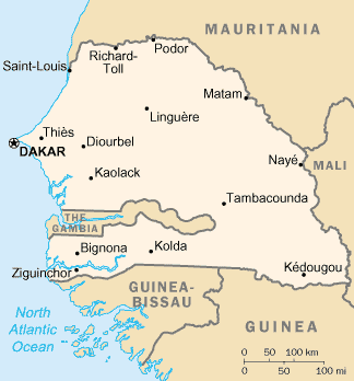
English: senegal map |
| Dagsetning | |
| Uppruni | CIA Worldfactory |
| Höfundarréttarhafi | Dubaduba |
| Aðrar útgáfur |
Derivative works of this file: Sg-map-sv.png - |
This image is in the public domain because it contains materials that originally came from the United States Central Intelligence Agency's World Factbook.
|
 |
Breytingaskrá skjals
Smelltu á dagsetningu eða tímasetningu til að sjá hvernig hún leit þá út.
| Dagsetning/Tími | Smámynd | Víddir | Notandi | Athugasemd | |
|---|---|---|---|---|---|
| núverandi | 20. maí 2014 kl. 01:48 | | 324 × 348 (9 KB) | Ras67 | cropped |
| 13. júní 2005 kl. 19:36 |  | 328 × 354 (10 KB) | Dubaduba~commonswiki | {{PD-USGov-CIA-WF}} Category:Senegal |
Skráartenglar
Eftirfarandi síða notar þessa skrá:
Altæk notkun skráar
Eftirfarandi wikar nota einnig þessa skrá:
- Notkun á am.wikipedia.org
- Notkun á ar.wikipedia.org
- Notkun á ast.wikipedia.org
- Notkun á azb.wikipedia.org
- Notkun á bg.wikipedia.org
- Notkun á bs.wikipedia.org
- Notkun á ca.wikipedia.org
- Resolució 294 del Consell de Seguretat de les Nacions Unides
- Resolució 178 del Consell de Seguretat de les Nacions Unides
- Resolució 204 del Consell de Seguretat de les Nacions Unides
- Resolució 273 del Consell de Seguretat de les Nacions Unides
- Resolució 321 del Consell de Seguretat de les Nacions Unides
- Notkun á dsb.wikipedia.org
- Notkun á en.wikipedia.org
- Notkun á eo.wikipedia.org
- Notkun á es.wikipedia.org
- Notkun á et.wikipedia.org
- Notkun á fa.wikipedia.org
- Notkun á fi.wikipedia.org
- Notkun á fi.wikivoyage.org
- Notkun á fr.wikipedia.org
- Notkun á he.wikipedia.org
- Notkun á hu.wikipedia.org
- Notkun á hu.wiktionary.org
- Notkun á it.wikipedia.org
- Notkun á ja.wikipedia.org
- Notkun á ka.wikipedia.org
- Notkun á kk.wikipedia.org
- Notkun á lb.wikipedia.org
- Notkun á lt.wikipedia.org
- Notkun á mdf.wikipedia.org
- Notkun á ml.wikipedia.org
- Notkun á ms.wikipedia.org
- Notkun á nl.wikipedia.org
- Notkun á no.wikipedia.org
- Notkun á pl.wikipedia.org
- Notkun á pt.wikipedia.org
Skoða frekari altæka notkun þessarar skráar.