Mynd:Plan Troy-Hisarlik-da.svg

Stærð þessarar PNG forskoðunar á SVG skránni: 664 × 599 mynddílar. Aðrar upplausnir: 266 × 240 mynddílar | 532 × 480 mynddílar | 851 × 768 mynddílar | 1.135 × 1.024 mynddílar | 2.270 × 2.048 mynddílar | 1.280 × 1.155 mynddílar.
Upphafleg skrá (SVG-skrá, að nafni til 1.280 × 1.155 mynddílar, skráarstærð: 158 KB)
| Lýsing |
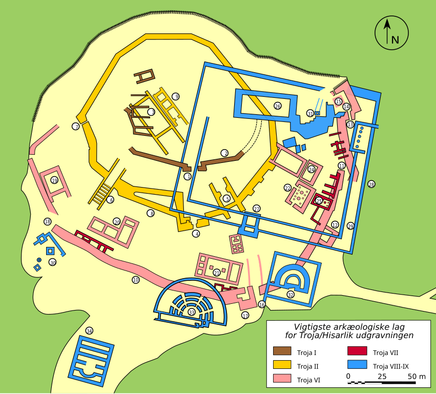
Dansk: Kort over den arkæologiske udgravning af Troja/Hisarlik.
Signaturforklaring:
|
||
| Dagsetning | (French original); 2007-09-21 (Danish translation) | ||
| Uppruni | Own work. Data from http://www.goddess-athena.org/Museum/Temples/Troy/Troy_Plan.html and http://clubachille.free.fr/img_armees/troie_plan.jpg. | ||
| Höfundarréttarhafi | Bibi Saint-Pol (French original); Sachse (Danish translation) | ||
| Réttindi (Endurnotkun á þessari skrá) |
|
||
| Aðrar útgáfur |
[]
|


|
This SVG file contains embedded text that can be translated into your language, using any capable SVG editor, text editor or the SVG Translate tool. For more information see: About translating SVG files. |
Breytingaskrá skjals
Smelltu á dagsetningu eða tímasetningu til að sjá hvernig hún leit þá út.
| Dagsetning/Tími | Smámynd | Víddir | Notandi | Athugasemd | |
|---|---|---|---|---|---|
| núverandi | 21. september 2007 kl. 09:40 | | 1.280 × 1.155 (158 KB) | Sachse | {{Information |Description=English: Plan of the archeological site of Troy/Hisarlik. Legend: * 1: Port * 2: Bymur * 3: Megarons * 4: FN Port * 5: FO Port * 6: FM Port og rampe * 7: FJ Port * 8: Bymur * 9: Megarons |
Skráartenglar
Eftirfarandi síða notar þessa skrá:
Altæk notkun skráar
Eftirfarandi wikar nota einnig þessa skrá: