Mynd:NOAA chart 25664 1976 detail.png
Stærð þessarar forskoðunar: 716 × 600 mynddílar Aðrar upplausnir: 287 × 240 mynddílar | 573 × 480 mynddílar | 906 × 759 mynddílar.
Upphafleg skrá (906 × 759 mynddílar, skráarstærð: 1,19 MB, MIME-gerð: image/png)
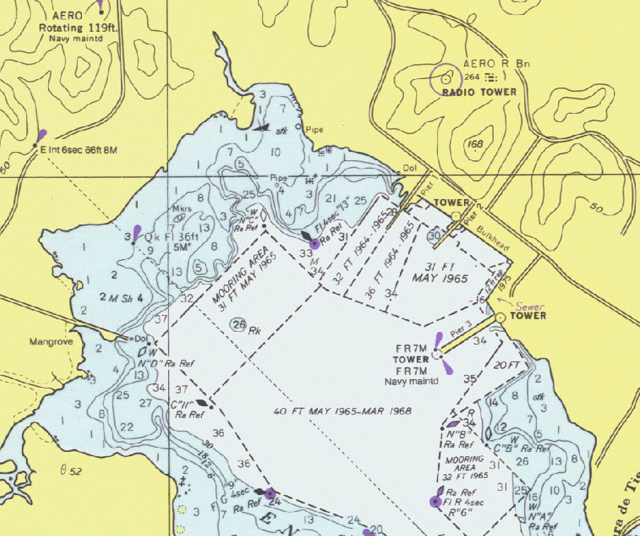
Lýsing
Detail of United States National Oceanic and Atmospheric Administration (NOAA) chart 25664 - Pasaje de Vieques and Radas Roosevelt, Puerto Rico.
This is from an outdated 1976 version of this chart; scanned by NOAA and provided through NOAA's Office of Coast Survey Historical Map and Chart Collection. Converted and clipped by the uploader.
Leyfisupplýsingar:
This image is in the public domain because it contains materials that originally came from the U.S. National Oceanic and Atmospheric Administration, taken or made as part of an employee's official duties.
|
Breytingaskrá skjals
Smelltu á dagsetningu eða tímasetningu til að sjá hvernig hún leit þá út.
| Dagsetning/Tími | Smámynd | Víddir | Notandi | Athugasemd | |
|---|---|---|---|---|---|
| núverandi | 1. janúar 2006 kl. 23:27 | | 906 × 759 (1,19 MB) | Cdc~commonswiki | Detail of United States National Oceanic and Atmospheric Administration (NOAA) chart 25664 - Pasaje de Vieques and Radas Roosevelt, Puerto Rico. This is from an outdated 1976 version of this chart; scanned by NOAA and provided through NOAA's Office of C |
Skráartenglar
Eftirfarandi síða notar þessa skrá:
Altæk notkun skráar
Eftirfarandi wikar nota einnig þessa skrá:
- Notkun á en.wikipedia.org
- Notkun á es.wikipedia.org
- Notkun á he.wikipedia.org