Mynd:Marmot-edit1.jpg

Stærð þessarar forskoðunar: 800 × 600 mynddílar Aðrar upplausnir: 320 × 240 mynddílar | 640 × 480 mynddílar | 1.024 × 768 mynddílar | 1.280 × 960 mynddílar | 2.272 × 1.704 mynddílar.
Upphafleg skrá (2.272 × 1.704 mynddílar, skráarstærð: 1,91 MB, MIME-gerð: image/jpeg)
Lýsing
| Lýsing |
العربية: مرموطٌ أصفر البطن على قمَّة جبل دانا، في مُنتزه يوسيميتي الوطني في كاليفورنيا. الطريق الظاهرة في الخلفيَّة هي طريق معبر تايوگا.
Deutsch: Murmeltier auf dem Mount Dana, Yosemite, Kalifornien, USA.
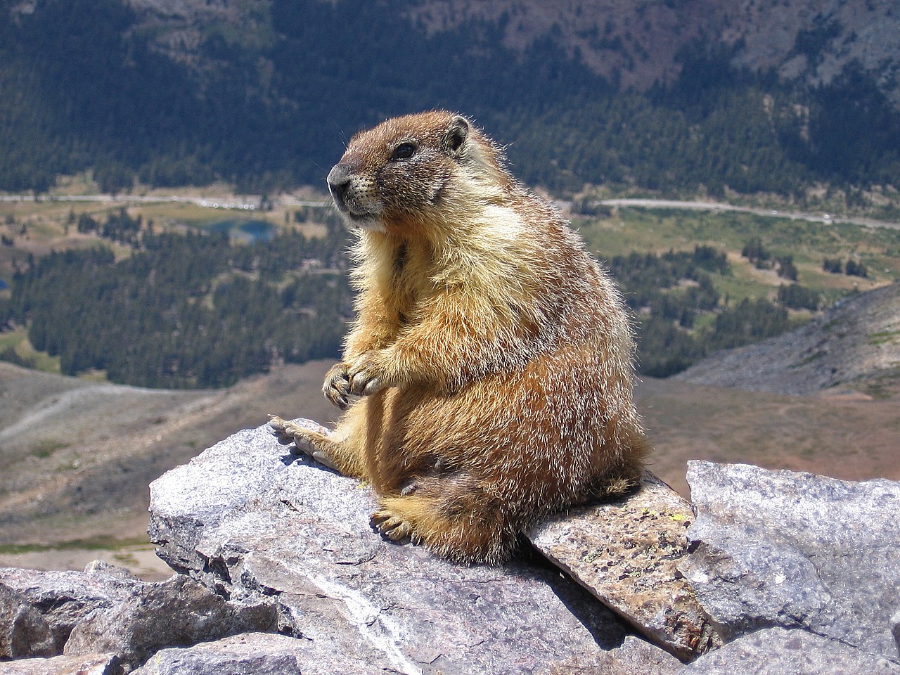
English: A marmot on top of Mount Dana, Yosemite, CA, USA. The road in the background is Tioga Pass Road.
Español: Marmota (Marmota flaviventris) en la cumbre del Monte Dana, Yosemite, California, Estados Unidos. En el fondo, la carretera a Tioga Pass.
Polski: Świstak żółtobrzuchy (Marmota flaviventris) na szczycie góry Mount Dana w Parku Narodowym Yosemite, w stanie Kalifornia, w USA. W tle widoczna jest droga Tioga Pass Road.
Čeština: Svišť žlutobřichý (Marmota flaviventris) sedící na vrcholku hory Mount Dana v Yosemitském národním parku, Kalifornie, USA.
Français : Une marmote charnue au sommet du Mont Dana, parc Yosemite, Californie, Etats-Unis. La route en fond est celle du col Tioga
Magyar: Sárgahasú mormota (Marmota flaviventris) a Mount Dana csúcsán. A háttérben a Tioga Pass Road (Yosemite Nemzeti Park, Kalifornia, Amerikai Egyesült Államok)
Italiano: Una marmotta in cima al Monte Dana, Parco nazionale di Yosemite, CA, USA. La strada sullo sfondo è la Tioga Pass Road
Македонски: Мрмот во националниот парк Јосемити, Калифорнија, САД.
Nederlands: Geelbuikmarmot (Marmota flaviventris) op de top van Mount Dana in Yosemite National Park in de Amerikaanse staat Californië
Português: Marmota (Marmota flaviventris) no cume do Monte Dana, Parque Nacional de Yosemite, Califórnia, Estados Unidos.
中文:美国加利福尼亚州约塞米蒂山达纳山上的土拨鼠。图中背景的道路是Tioga通道。 |
| Dagsetning | Taken on 2. ágúst 2007 |
| Uppruni |
This file was derived from: Marmot on rocks.jpg |
| Höfundarréttarhafi | |
| Aðrar útgáfur |
Sharpened and curve adjustment of the original: |

| Camera location | | View this and other nearby images on: OpenStreetMap |
|---|

Assessment
This image was selected as picture of the day on Wikimedia Commons for 2 February 2018. It was captioned as follows: English: A marmot seen on top of Mount Dana, Yosemite, CA, USA. The road in the background is Tioga Pass Road Other languages:
Čeština: Svišť žlutobřichý (Marmota flaviventris) sedící na vrcholku hory Mount Dana v Yosemitském národním parku, Kalifornie, USA. English: A marmot seen on top of Mount Dana, Yosemite, CA, USA. The road in the background is Tioga Pass Road Español: Marmota (Marmota flaviventris) en la cumbre del Monte Dana, Yosemite, California, Estados Unidos. En el fondo, la carretera a Tioga Pass. Français : Une marmote charnue au sommet du Mont Dana, parc Yosemite, Californie, Etats-Unis. La route en fond est celle du col Tioga Italiano: Una marmotta in cima al Monte Dana, Parco nazionale di Yosemite, CA, USA. La strada sullo sfondo è la Tioga Pass Road Magyar: Sárgahasú mormota (Marmota flaviventris) a Mount Dana csúcsán. A háttérben a Tioga Pass Road (Yosemite Nemzeti Park, Kalifornia, Amerikai Egyesült Államok) Nederlands: Geelbuikmarmot (Marmota flaviventris) op de top van Mount Dana in Yosemite National Park in de Amerikaanse staat Californië Polski: Świstak żółtobrzuchy (Marmota flaviventris) na szczycie góry Mount Dana w Parku Narodowym Yosemite, w stanie Kalifornia, w USA. W tle widoczna jest droga Tioga Pass Road. Português: Marmota (Marmota flaviventris) no cume do Monte Dana, Parque Nacional de Yosemite, Califórnia, Estados Unidos. Македонски: Мрмот во националниот парк Јосемити, Калифорнија, САД. 中文: 美国加利福尼亚州约塞米蒂山达纳山上的土拨鼠。图中背景的道路是Tioga通道。 |
|
Leyfisupplýsingar:
Inklein from en.wikipedia.org, the copyright holder of this work, hereby publishes it under the following license:

|
Gefið er leyfi til að afrita, dreifa og/eða breyta þessu skjali samkvæmt Frjálsa GNU Free Documentation License, útgáfu 1.2 eða nýrri, sem gefið er út af Frjálsu hugbúnaðarstofnuninni með engum breytingum þar á. Afrit af leyfinu er innifalið í kaflanum GNU Free Documentation License. |
| Þessi skrá er með Creative Commons Tilvísun-DeilaEins 3.0 Óstaðfært notkunarleyfi. | ||
| Tilvísun höfundarréttar: Inklein | ||
| ||
| This licensing tag was added to this file as part of the GFDL licensing update. |
Breytingaskrá skjals
Smelltu á dagsetningu eða tímasetningu til að sjá hvernig hún leit þá út.
| Dagsetning/Tími | Smámynd | Víddir | Notandi | Athugasemd | |
|---|---|---|---|---|---|
| núverandi | 3. september 2007 kl. 10:07 | | 2.272 × 1.704 (1,91 MB) | Jjron | {{Information |Description= A marmot seen on top of Mount Dana, Yosemite, CA, USA. The road in the background is Tioga Pass Road. (Edited version of original: sharpened and curve adjustment by jjron |Source= English Wikipedia |Date=2 Septe |
Skráartenglar
Eftirfarandi síða notar þessa skrá:
Altæk notkun skráar
Eftirfarandi wikar nota einnig þessa skrá:
- Notkun á ar.wikipedia.org
- مرموط
- مرموط أصفر البطن
- ويكيبيديا:صور مختارة/حيوانات/ثدييات
- بوابة:قوارض
- بوابة:قوارض/صورة مختارة/أرشيف
- بوابة:قوارض/صورة مختارة/12
- ويكيبيديا:ترشيحات الصور المختارة/مرموط جالس
- ويكيبيديا:صورة اليوم المختارة/أكتوبر 2019
- قالب:صورة اليوم المختارة/2019-10-19
- ويكيبيديا:صورة اليوم المختارة/أغسطس 2021
- قالب:صورة اليوم المختارة/2021-08-09
- Notkun á arz.wikipedia.org
- Notkun á ast.wikipedia.org
- Notkun á avk.wikipedia.org
- Notkun á az.wikipedia.org
- Notkun á be-tarask.wikipedia.org
- Notkun á bg.wikipedia.org
- Notkun á bo.wikipedia.org
- Notkun á br.wikipedia.org
- Notkun á ca.wikipedia.org
- Notkun á ceb.wikipedia.org
- Notkun á crh.wikipedia.org
- Notkun á cs.wikipedia.org
- Notkun á cv.wikipedia.org
- Notkun á de.wikipedia.org
- Notkun á de.wiktionary.org
- Notkun á el.wikipedia.org
- Notkun á en.wikipedia.org
- Ground squirrel
- Bibliography of the Sierra Nevada
- Yellow-bellied marmot
- Talk:Marmot
- User:Inklein
- User talk:Inklein
- Wikipedia:Featured pictures/Animals/Mammals
- Wikipedia:Featured pictures thumbs/08
- List of mammals of Canada
- Wikipedia:Featured picture candidates/September-2007
- Wikipedia:Featured picture candidates/Marmot
- Wikipedia:Wikipedia Signpost/2007-09-10/Features and admins
- Wikipedia:Wikipedia Signpost/2007-09-10/SPV
- User talk:Jjron/Archive 2
- Wikipedia:Picture of the day/December 2007
- Template:POTD/2007-12-26
- Portal:Mammals/Selected pictures
- Portal:Mammals/Selected pictures/9
Skoða frekari altæka notkun þessarar skráar.