Mynd:MagdeburgCenter.jpg

Stærð þessarar forskoðunar: 800 × 600 mynddílar Aðrar upplausnir: 320 × 240 mynddílar | 640 × 480 mynddílar | 1.024 × 768 mynddílar | 1.280 × 960 mynddílar | 2.272 × 1.704 mynddílar.
Upphafleg skrá (2.272 × 1.704 mynddílar, skráarstærð: 1.016 KB, MIME-gerð: image/jpeg)
Lýsing
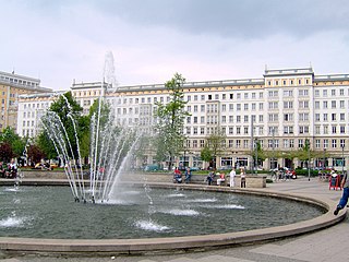
| Lýsing | Magdeburg, Ernst-Reuter-Allee |
| Dagsetning | |
| Uppruni | self-made, upload from Engwiki: [1] |
| Höfundarréttarhafi | ProhibitOnions |
![[1]](https://en.wikipedia.org/wiki/Image:MagdeburgStalinist.jpg)
| Camera location | | View this and other nearby images on: OpenStreetMap |
|---|
Leyfisupplýsingar:
| I, the copyright holder of this work, release this work into the public domain. This applies worldwide. In some countries this may not be legally possible; if so: I grant anyone the right to use this work for any purpose, without any conditions, unless such conditions are required by law. |
Breytingaskrá skjals
Smelltu á dagsetningu eða tímasetningu til að sjá hvernig hún leit þá út.
| Dagsetning/Tími | Smámynd | Víddir | Notandi | Athugasemd | |
|---|---|---|---|---|---|
| núverandi | 2. júní 2007 kl. 19:52 | | 2.272 × 1.704 (1.016 KB) | Unify~commonswiki | {{Information |Description=City center of Magdeburg |Source=self-made, upload from Engwiki: [http://en.wikipedia.org/wiki/Image:MagdeburgStalinist.jpg] |Date=2005 |Author= ProhibitOnions }} |
Skráartenglar
Eftirfarandi síða notar þessa skrá:
Altæk notkun skráar
Eftirfarandi wikar nota einnig þessa skrá:
- Notkun á af.wikipedia.org
- Notkun á de.wikipedia.org
- Notkun á fr.wikipedia.org
- Notkun á hu.wikipedia.org
- Notkun á it.wikipedia.org
- Notkun á nds.wikipedia.org
- Notkun á pl.wikipedia.org
- Notkun á sv.wikipedia.org
- Notkun á www.wikidata.org