Mynd:La2-demis-ladoga.png
Stærð þessarar forskoðunar: 488 × 600 mynddílar Aðrar upplausnir: 195 × 240 mynddílar | 638 × 784 mynddílar.
Upphafleg skrá (638 × 784 mynddílar, skráarstærð: 71 KB, MIME-gerð: image/png)
Lýsing
| Lýsing |
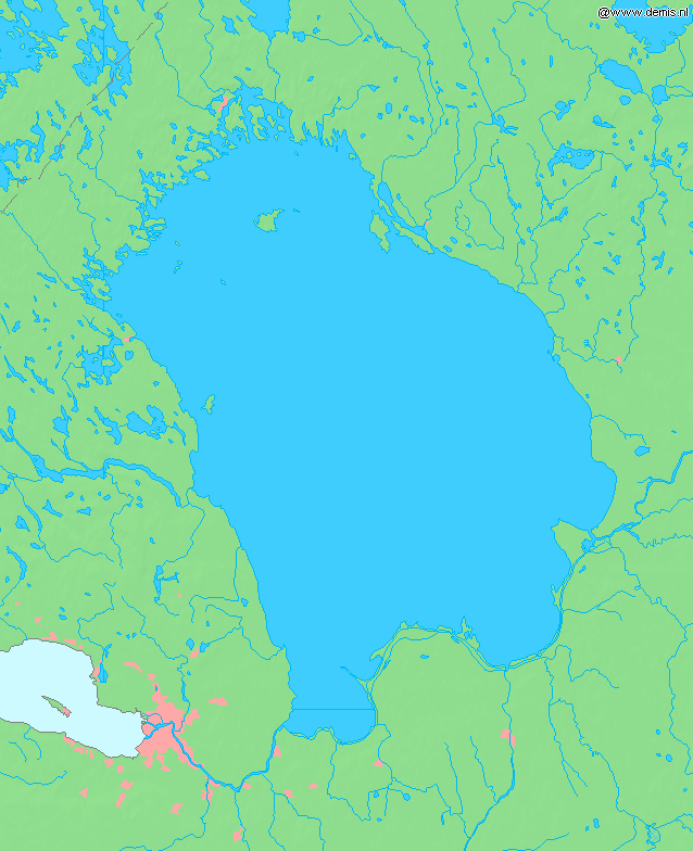
English: Lake Ladoga, in Russia.
Bounding box West 29.4°, South 59.6°, East 33.4°, North 62.0°. Center at 60°48′00″N 31°24′00″E / 60.80000°N 31.40000°E. |
| Dagsetning | |
| Uppruni | Demis map server |
| Höfundarréttarhafi | Demis map server |
This image is in the public domain because it came from the site https://www.demis.nl/products/web-map-server/examples/ and was released by the copyright holder. Permission is granted to copy, distribute and/or modify this map since it is based on free of copyright images from: www.demis.nl. See also approval email on de.wp and its clarification.
|
| This work has been released into the public domain by its copyright holder, www.demis.nl. This applies worldwide. In some countries this may not be legally possible; if so: www.demis.nl grants anyone the right to use this work for any purpose, without any conditions, unless such conditions are required by law.
|
derivative works
Derivative works of this file: Ладогӕйы цад.png
Breytingaskrá skjals
Smelltu á dagsetningu eða tímasetningu til að sjá hvernig hún leit þá út.
| Dagsetning/Tími | Smámynd | Víddir | Notandi | Athugasemd | |
|---|---|---|---|---|---|
| núverandi | 30. ágúst 2005 kl. 11:09 | | 638 × 784 (71 KB) | LA2 | Lake Ladoga in Russia. {{demis-pd}} category:Maps of Russia |
Skráartenglar
Eftirfarandi síða notar þessa skrá:
Altæk notkun skráar
Eftirfarandi wikar nota einnig þessa skrá:
- Notkun á bg.wikipedia.org
- Notkun á bn.wikipedia.org
- Notkun á cs.wikipedia.org
- Notkun á cu.wikipedia.org
- Notkun á en.wikipedia.org
- Notkun á es.wikipedia.org
- Notkun á et.wikipedia.org
- Notkun á fa.wikipedia.org
- Notkun á fi.wikipedia.org
- Notkun á fr.wikipedia.org
- Notkun á gl.wikipedia.org
- Notkun á hr.wikipedia.org
- Notkun á id.wikipedia.org
- Notkun á incubator.wikimedia.org
- Notkun á it.wikibooks.org
- Notkun á ja.wikipedia.org
- Notkun á ko.wikipedia.org
- Notkun á la.wikipedia.org
- Notkun á lv.wikipedia.org
- Notkun á mai.wikipedia.org
- Notkun á ms.wikipedia.org
- Notkun á ne.wikipedia.org
- Notkun á nl.wikipedia.org
- Notkun á nn.wikipedia.org
- Notkun á no.wikipedia.org
- Notkun á pa.wikipedia.org
- Notkun á pl.wiktionary.org
- Notkun á pt.wikipedia.org
- Notkun á ro.wikipedia.org
- Notkun á sh.wikipedia.org
- Notkun á sk.wikipedia.org
- Notkun á sl.wikipedia.org
- Notkun á sr.wikipedia.org
- Notkun á sw.wikipedia.org
- Notkun á th.wikipedia.org
- Notkun á tr.wikipedia.org
- Notkun á uk.wikipedia.org
- Notkun á uz.wikipedia.org
- Notkun á vep.wikipedia.org
Skoða frekari altæka notkun þessarar skráar.