Mynd:Haga Comitis - Den Haag (Atlas van Loon).jpg

Stærð þessarar forskoðunar: 773 × 599 mynddílar Aðrar upplausnir: 310 × 240 mynddílar | 619 × 480 mynddílar | 991 × 768 mynddílar | 1.280 × 992 mynddílar | 2.560 × 1.985 mynddílar | 5.334 × 4.135 mynddílar.
Upphafleg skrá (5.334 × 4.135 mynddílar, skráarstærð: 7,95 MB, MIME-gerð: image/jpeg)
Lýsing
| Lýsing |
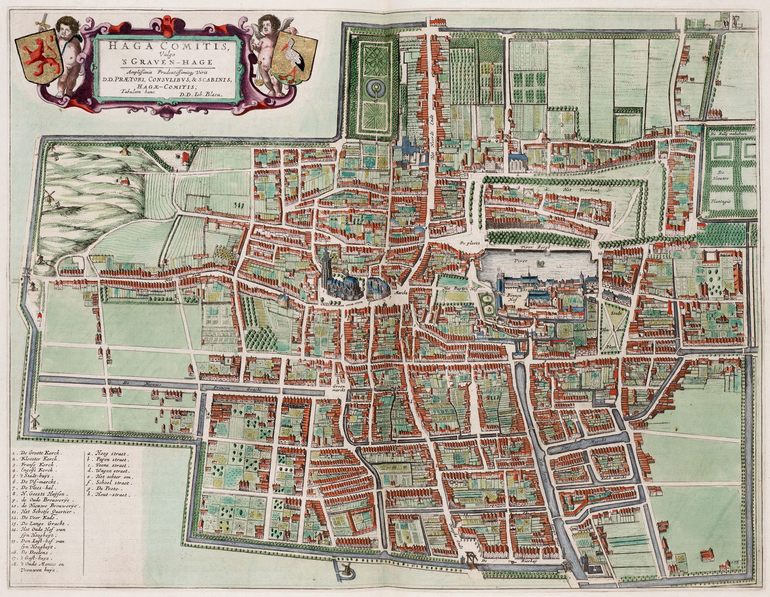
English: Map of Den Haag |
||||||||||||||||||||||||||
| Dagsetning | |||||||||||||||||||||||||||
| Uppruni | Atlas van Loon | ||||||||||||||||||||||||||
| Höfundarréttarhafi |
|
||||||||||||||||||||||||||
.jpg)
.jpg)
Leyfisupplýsingar:
|
This is a faithful photographic reproduction of a two-dimensional, public domain work of art. The work of art itself is in the public domain in its source country for the following reason:
It is also in the public domain in the United States for the following reason:
The official position taken by the Wikimedia Foundation is that "faithful reproductions of two-dimensional public domain works of art are public domain".
This photographic reproduction is therefore also considered to be in the public domain in the United States. In other jurisdictions, re-use of this content may be restricted; see Reuse of PD-Art photographs for details.
| ||||||
Breytingaskrá skjals
Smelltu á dagsetningu eða tímasetningu til að sjá hvernig hún leit þá út.
| Dagsetning/Tími | Smámynd | Víddir | Notandi | Athugasemd | |
|---|---|---|---|---|---|
| núverandi | 26. janúar 2013 kl. 07:03 | | 5.334 × 4.135 (7,95 MB) | Slick-o-bot | Bot: convert to a non-interlaced jpeg (see bug #17645) |
| 21. október 2009 kl. 22:24 |  | 5.334 × 4.135 (7,75 MB) | Kweniston | {{Information |Description={{en|1=Map of Den Haag}} |Source=Atlas van Loon |Author=unknown |Date=1649 |Permission= |other_versions= }} Category:Old maps of The Hague Category:Atlas van Loon |
Skráartenglar
Eftirfarandi síða notar þessa skrá:
Altæk notkun skráar
Eftirfarandi wikar nota einnig þessa skrá:
- Notkun á de.wikipedia.org
- Notkun á en.wikipedia.org
- Notkun á eo.wikipedia.org
- Notkun á fr.wikipedia.org
- Notkun á nl.wikipedia.org
- Notkun á zh.wikipedia.org
.jpg)