Mynd:Extent of Western Roman Empire 395.png
Það er engin hærri upplausn til.
Extent_of_Western_Roman_Empire_395.png (493 × 548 mynddílar, skráarstærð: 40 KB, MIME-gerð: image/png)

|
This historical map image could be re-created using vector graphics as an SVG file. This has several advantages; see Commons:Media for cleanup for more information. If an SVG form of this image is available, please upload it and afterwards replace this template with
{{vector version available|new image name}}.
It is recommended to name the SVG file “Extent of Western Roman Empire 395.svg”—then the template Vector version available (or Vva) does not need the new image name parameter. |
Lýsing
| Lýsing |
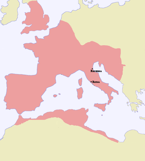
Español: Extensión del Imperio romano de occidente en 395.dC, a la muerte de Teodosio I. |
| Dagsetning | |
| Uppruni | |
| Höfundarréttarhafi |
Leyfisupplýsingar:
| I, the copyright holder of this work, release this work into the public domain. This applies worldwide. In some countries this may not be legally possible; if so: I grant anyone the right to use this work for any purpose, without any conditions, unless such conditions are required by law. |
Breytingaskrá skjals
Smelltu á dagsetningu eða tímasetningu til að sjá hvernig hún leit þá út.
| Dagsetning/Tími | Smámynd | Víddir | Notandi | Athugasemd | |
|---|---|---|---|---|---|
| núverandi | 7. febrúar 2006 kl. 21:19 | | 493 × 548 (40 KB) | Tokle |
Skráartenglar
Eftirfarandi síða notar þessa skrá:
Altæk notkun skráar
Eftirfarandi wikar nota einnig þessa skrá:
- Notkun á af.wikipedia.org
- Notkun á als.wikipedia.org
- Notkun á bg.wikipedia.org
- Notkun á bs.wikipedia.org
- Notkun á cs.wikipedia.org
- Notkun á de.wikipedia.org
- Notkun á en.wikipedia.org
- Notkun á eo.wikipedia.org
- Notkun á es.wikipedia.org
- Notkun á pl.wikipedia.org
- Notkun á sh.wikipedia.org
- Notkun á sk.wikipedia.org
- Notkun á sr.wikipedia.org
- Notkun á sw.wikipedia.org