Mynd:Athanasius Kircher's Atlantis.gif
Það er engin hærri upplausn til.
Athanasius_Kircher's_Atlantis.gif (617 × 410 mynddílar, skráarstærð: 36 KB, MIME-gerð: image/gif)
| Lýsing |
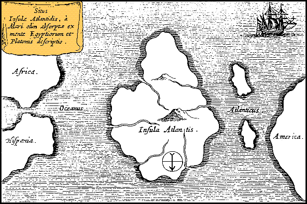
Latina: Situs Insulae Atlantidis, a mari olim absorpte ex mente Aegyptiorum et Platonis descriptio.
Русский: Карта Атлантиды Афанасия Кирхера, 1669 год. Обратите внимание, север, как показано стрелкой на карте, расположен в нижней части. |
|||||||||||||||||||||||
| Dagsetning | circa 1669 | |||||||||||||||||||||||
| Uppruni | https://www.haktanir.org/ | |||||||||||||||||||||||
| Höfundarréttarhafi |
|
|||||||||||||||||||||||
| Aðrar útgáfur |
|
|||||||||||||||||||||||


.jpg)
|
This work is in the public domain in its country of origin and other countries and areas where the copyright term is the author's life plus 100 years or fewer. | |
| This file has been identified as being free of known restrictions under copyright law, including all related and neighboring rights. | |
Breytingaskrá skjals
Smelltu á dagsetningu eða tímasetningu til að sjá hvernig hún leit þá út.
| Dagsetning/Tími | Smámynd | Víddir | Notandi | Athugasemd | |
|---|---|---|---|---|---|
| núverandi | 15. október 2013 kl. 12:39 | | 617 × 410 (36 KB) | AnonMoos | Reverted to version as of 01:05, 29 December 2005 -- rotating image turned text upside down |
| 15. október 2013 kl. 12:37 |  | 617 × 410 (36 KB) | Rotatebot | Bot: Image rotated by 180° | |
| 29. desember 2005 kl. 01:05 |  | 617 × 410 (36 KB) | Comae | Tomado de en.wikipedia, donde dice: Author: Athanasius_Kircher's Map of Atlantis (c.1669) Source: http://atlants.haktanir.org/ch3.html This image is in the public domain because its copyright has expired in the United States and those countries with a c |
Skráartenglar
Eftirfarandi síða notar þessa skrá:
Altæk notkun skráar
Eftirfarandi wikar nota einnig þessa skrá:
- Notkun á af.wikipedia.org
- Notkun á an.wikipedia.org
- Notkun á ar.wikipedia.org
- Notkun á ar.wikiversity.org
- Notkun á ast.wikipedia.org
- Notkun á az.wikipedia.org
- Notkun á be-tarask.wikipedia.org
- Notkun á beta.wikiversity.org
- Notkun á be.wikipedia.org
- Notkun á bg.wikipedia.org
- Notkun á bn.wikipedia.org
- Notkun á ca.wikipedia.org
- Notkun á ceb.wikipedia.org
- Notkun á cs.wikipedia.org
- Notkun á de.wikipedia.org
- Notkun á diq.wikipedia.org
- Notkun á el.wikipedia.org
- Notkun á en.wikipedia.org
- Notkun á en.wikibooks.org
- Notkun á en.wikiversity.org
- Notkun á en.wikivoyage.org
- Notkun á eo.wikipedia.org
- Notkun á es.wikipedia.org
- Notkun á es.wikibooks.org
- Notkun á et.wikipedia.org
- Notkun á eu.wikipedia.org
- Notkun á fi.wikibooks.org
- Notkun á fr.wiktionary.org
- Notkun á fy.wikipedia.org
- Notkun á gl.wikipedia.org
Skoða frekari altæka notkun þessarar skráar.