Mynd:AmundsenSea.jpg
Stærð þessarar forskoðunar: 800 × 566 mynddílar Aðrar upplausnir: 320 × 226 mynddílar | 640 × 452 mynddílar | 1.024 × 724 mynddílar | 1.280 × 905 mynddílar | 2.808 × 1.985 mynddílar.
Upphafleg skrá (2.808 × 1.985 mynddílar, skráarstærð: 1,12 MB, MIME-gerð: image/jpeg)
Lýsing
| Lýsing |
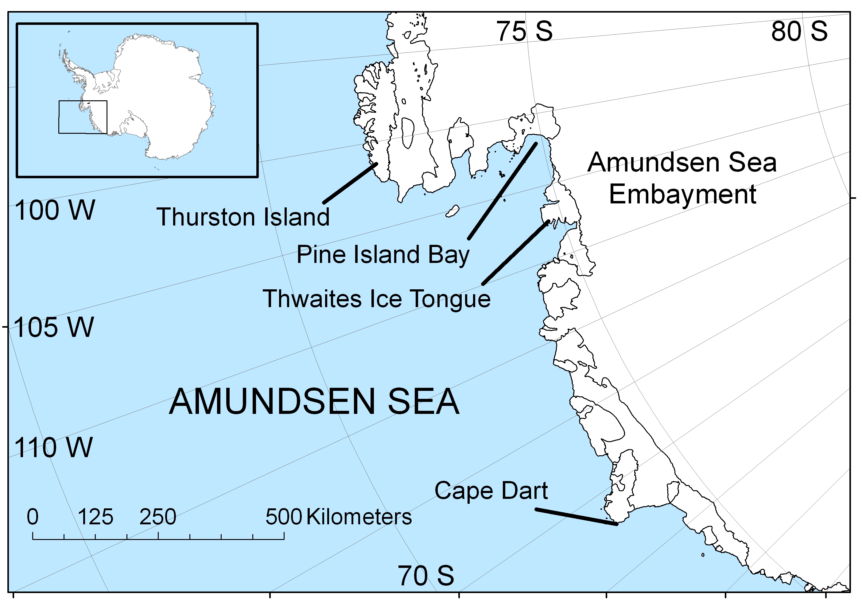
English: Map of the Amundsen Sea area of Antarctica |
| Dagsetning | |
| Uppruni | eigin skrá |
| Höfundarréttarhafi | Polargeo |
| Aðrar útgáfur | العربيَّة |
Leyfisupplýsingar:
| I, the copyright holder of this work, release this work into the public domain. This applies worldwide. In some countries this may not be legally possible; if so: I grant anyone the right to use this work for any purpose, without any conditions, unless such conditions are required by law. |
Breytingaskrá skjals
Smelltu á dagsetningu eða tímasetningu til að sjá hvernig hún leit þá út.
| Dagsetning/Tími | Smámynd | Víddir | Notandi | Athugasemd | |
|---|---|---|---|---|---|
| núverandi | 30. apríl 2009 kl. 16:22 | | 2.808 × 1.985 (1,12 MB) | Polargeo | {{Information |Description={{en|1=Map of the Amundsen Sea area of Antarctica}} |Source=Own work by uploader |Author=Polargeo |Date=2009-04-30 |Permission= |other_versions= }} <!--{{ImageUpload|full}}--> |
Skráartenglar
Eftirfarandi síða notar þessa skrá:
Altæk notkun skráar
Eftirfarandi wikar nota einnig þessa skrá:
- Notkun á af.wikipedia.org
- Notkun á ar.wikipedia.org
- Notkun á arz.wikipedia.org
- Notkun á ast.wikipedia.org
- Notkun á az.wikipedia.org
- Notkun á bs.wikipedia.org
- Notkun á ca.wikipedia.org
- Notkun á cs.wikipedia.org
- Notkun á cy.wikipedia.org
- Notkun á da.wikipedia.org
- Notkun á de.wikipedia.org
- Notkun á en.wikipedia.org
- Notkun á eo.wikipedia.org
- Notkun á es.wikipedia.org
- Notkun á eu.wikipedia.org
- Notkun á fa.wikipedia.org
- Notkun á fi.wikipedia.org
- Notkun á fr.wikipedia.org
- Notkun á fy.wikipedia.org
- Notkun á gl.wikipedia.org
- Notkun á he.wikipedia.org
- Notkun á hu.wikipedia.org
- Notkun á hy.wikipedia.org
- Notkun á hyw.wikipedia.org
- Notkun á id.wikipedia.org
- Notkun á ilo.wikipedia.org
- Notkun á ja.wikipedia.org
- Notkun á ko.wikipedia.org
- Notkun á la.wikipedia.org
- Notkun á lt.wikipedia.org
- Notkun á mk.wikipedia.org
- Notkun á ml.wikipedia.org
- Notkun á ms.wikipedia.org
- Notkun á nl.wikipedia.org
- Notkun á nn.wikipedia.org
- Notkun á pa.wikipedia.org
- Notkun á pl.wikipedia.org
- Notkun á pnb.wikipedia.org
- Notkun á pt.wikipedia.org
- Notkun á simple.wikipedia.org
- Notkun á sr.wikipedia.org
- Notkun á sw.wikipedia.org
Skoða frekari altæka notkun þessarar skráar.