Mynd:Vanuatu Provinces.JPG
Stærð þessarar forskoðunar: 549 × 599 mynddílar Aðrar upplausnir: 220 × 240 mynddílar | 558 × 609 mynddílar.
Upphafleg skrá (558 × 609 mynddílar, skráarstærð: 36 KB, MIME-gerð: image/jpeg)
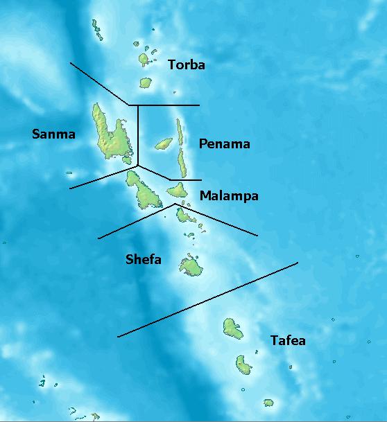
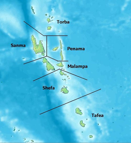
Map of Provinces of Vanuatu. Created with DEMIS World Map Server[dead link]
License: http://www2.demis.nl/mapserver/DataSrc.htm archive copy at the Wayback Machine
| This work has been released into the public domain by its author, DEMIS BV. This applies worldwide. In some countries this may not be legally possible; if so: DEMIS BV grants anyone the right to use this work for any purpose, without any conditions, unless such conditions are required by law.
|
Breytingaskrá skjals
Smelltu á dagsetningu eða tímasetningu til að sjá hvernig hún leit þá út.
| Dagsetning/Tími | Smámynd | Víddir | Notandi | Athugasemd | |
|---|---|---|---|---|---|
| núverandi | 25. júlí 2005 kl. 00:10 | | 558 × 609 (36 KB) | Taichi | Map of Provinces of Vanuatu. Created with [ http://www2.demis.nl/mapserver/mapper.asp DEMIS World Map Server] License: http://www2.demis.nl/mapserver/DataSrc.htm {{PD}} Category:Maps |
Skráartenglar
Eftirfarandi síða notar þessa skrá:
Altæk notkun skráar
Eftirfarandi wikar nota einnig þessa skrá:
- Notkun á als.wikipedia.org
- Notkun á arz.wikipedia.org
- Notkun á az.wikipedia.org
- Notkun á bi.wikipedia.org
- Notkun á bjn.wikipedia.org
- Notkun á ceb.wikipedia.org
- Notkun á cs.wikipedia.org
- Notkun á da.wikipedia.org
- Notkun á de.wikipedia.org
- Notkun á el.wikipedia.org
- Notkun á en.wikipedia.org
- Notkun á eo.wikipedia.org
- Notkun á es.wikipedia.org
- Notkun á et.wikipedia.org
- Notkun á eu.wikipedia.org
- Notkun á fi.wikipedia.org
- Notkun á fi.wiktionary.org
- Notkun á frr.wikipedia.org
- Notkun á fr.wikipedia.org
- Notkun á fr.wiktionary.org
- Notkun á gl.wikipedia.org
- Notkun á hi.wikipedia.org
- Notkun á hr.wikipedia.org
Skoða frekari altæka notkun þessarar skráar.