Mynd:Mexico estados densidad.svg

Stærð þessarar PNG forskoðunar á SVG skránni: 800 × 544 mynddílar. Aðrar upplausnir: 320 × 218 mynddílar | 640 × 435 mynddílar | 1.024 × 696 mynddílar | 1.280 × 870 mynddílar | 2.560 × 1.741 mynddílar | 1.000 × 680 mynddílar.
Upphafleg skrá (SVG-skrá, að nafni til 1.000 × 680 mynddílar, skráarstærð: 179 KB)
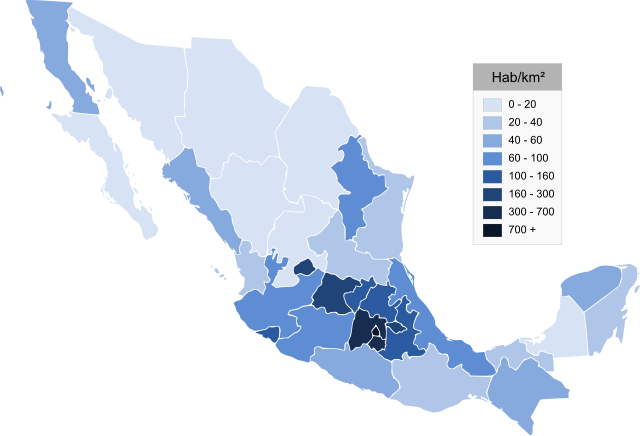
| Lýsing | Map of Mexico, Mapa de Mexico, se muestra la densidad de población | ||
| Dagsetning | (UTC) | ||
| Uppruni | |||
| Höfundarréttarhafi |
|
| This is a retouched picture, which means that it has been digitally altered from its original version. Modifications: svg. The original can be viewed here: Mexico estados densidad.png:
|
I, the copyright holder of this work, hereby publish it under the following licenses:

|
Gefið er leyfi til að afrita, dreifa og/eða breyta þessu skjali samkvæmt Frjálsa GNU Free Documentation License, útgáfu 1.2 eða nýrri, sem gefið er út af Frjálsu hugbúnaðarstofnuninni með engum breytingum þar á. Afrit af leyfinu er innifalið í kaflanum GNU Free Documentation License. |
| Þessi skrá er með Creative Commons Tilvísun-DeilaEins 3.0 Óstaðfært notkunarleyfi. | ||
| ||
| This licensing tag was added to this file as part of the GFDL licensing update. |
| I, the copyright holder of this work, release this work into the public domain. This applies worldwide. In some countries this may not be legally possible; if so: I grant anyone the right to use this work for any purpose, without any conditions, unless such conditions are required by law. |
Þú mátt velja notkunarleyfi að eigin vali.
Original upload log
This image is a derivative work of the following images:
- File:Mexico_estados_densidad.png licensed with GFDL, PD-self
- 2006-07-28T05:34:18Z Ek Balam 1000x682 (36070 Bytes) {{Information |Description= Map of Mexico, Mapa de Mexico, se muestra la densidad de población |Source= http://commons.wikimedia.org/wiki/Image:Mexico_states_blank.png |Date= 28 07 2006 |Author= Mario Fuente Cid, from a map
Uploaded with derivativeFX
Breytingaskrá skjals
Smelltu á dagsetningu eða tímasetningu til að sjá hvernig hún leit þá út.
| Dagsetning/Tími | Smámynd | Víddir | Notandi | Athugasemd | |
|---|---|---|---|---|---|
| núverandi | 21. maí 2009 kl. 23:34 | | 1.000 × 680 (179 KB) | Addicted04 | trazo |
| 21. maí 2009 kl. 23:32 |  | 1.000 × 680 (130 KB) | Addicted04 | {{Information |Description=Map of Mexico, Mapa de Mexico, se muestra la densidad de población |Source=*File:Mexico_estados_densidad.png |Date=2009-05-22 00:31 (UTC) |Author=*File:Mexico_estados_densidad.png: Mario Fuente Cid, from a map by Ja |
Skráartenglar
Eftirfarandi síða notar þessa skrá:
Altæk notkun skráar
Eftirfarandi wikar nota einnig þessa skrá:
- Notkun á af.wikipedia.org
- Notkun á ar.wikipedia.org
- Notkun á arz.wikipedia.org
- Notkun á bg.wikipedia.org
- Notkun á ca.wikipedia.org
- Notkun á cs.wikipedia.org
- Notkun á en.wikipedia.org
- Notkun á es.wikipedia.org
- Notkun á hr.wikipedia.org
- Notkun á ia.wikipedia.org
- Notkun á la.wikipedia.org
- Notkun á lt.wikipedia.org
- Notkun á pl.wikipedia.org
- Notkun á pt.wikipedia.org
- Notkun á ru.wikipedia.org
- Notkun á sc.wikipedia.org
- Notkun á sk.wikipedia.org
- Notkun á uk.wikipedia.org
- Notkun á ur.wikipedia.org
- Notkun á www.wikidata.org